Thursday, July 1, 2010

Reaching the Northern Terminus via Bangor, Maine. June 2010

Starting Off
June 21, 2010
Flew from Chicago to Bangor with, a stop over in Philadephia on Monday, June 21st.  At the luggage pickup in Bangor I felt great relief to see my big box,which was taped up the night before by Jonathan, bobbing down the belt.  In it was my backpack and all my gear.   From Bangor Airport I hiked to the Cyr Bus Station and purchased a ticket north to the town of Medway.  After a few hours of waiting my bus pulled in.  It was running a little late.  The driver hopped off.  He was a tall, clean cut man with a fist full of turquoise rings and a gold chain around his neck.  The driver was wearing a big cowboy hat and had an easy manner about him.  He directed the gathering crowd where the luggage was to be stowed in the belly of the bus and then went to the door to take tickets.   As the bus took off he played,  "1000 MIles To GO," by Johnny Cash.  And interrupted the song with his own little improvised song about the bus route, about being a little behind schedule, and how he intended to make up the lost time.  Je had a beautiful deep voice and I was sorry when he finished. I had taken a seat behind a guy with a big backpack.  I quickly noticed that he smelled really bad but I decided to stay in my seat after realizing that I'd no doubt smell that bad in  about a week.
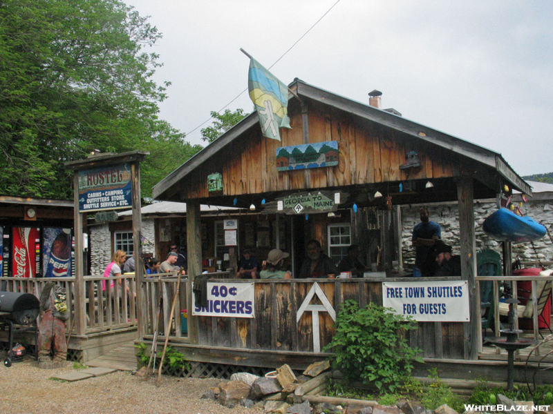
The bus let me and two other hikers off in Medway at a Gas Station.  Paul, "Old Man," as he is called, was there in his Chevy Suburban to shuttle us to the Appalachian Trail Lodge and Cafe in Millinocket.  The AT Lodge and Cafe is run from a big, two story frame house in the small town of Millinocket.  The resturant, or cafe, is a couple of blocks down the street.  Upstairs, there is a bunk house for hikers coming and going from the AT.  The bunk house has two rooms of beds, a bathroom with a shower, and a kitchen area.  When we arrived we met two NOBOs (North Bound Thru-hikers) who had been picked up by Paul that morning.  They had completed the AT from Georgia to Maine and were thought to be the 7th and 8th hikers for 2010.  These two guys were extrememly pround in a quiet sort of way.  Consider the Awesomeness.  They had some amazing stories to tell and photographs to show. 
We all talked.  The two hikers who came in with me gave me one third of the cost of the camp site I had reserved for the following day at Baxter State Park.  They hadn't made reservations and I did, so it worked out really well that we shared a site.  They were both young men in their 20s.  One guy had just graduated college and didn't find a suitable job, so decided to hike the AT.  The other guy was a musician in a Blue Grass Band that had just broken up.  He decided it was the perfect time to hike the AT.  I thought it was a good time to hike the AT too.   We all went to sleep in preparation for the following day: Katahadin.

image found at:  http://www.baxter-state-park.com/links/mountkatahdin-baxterstatepark-campingfishinghiking.html

In the morning we all went down to the cafe for the breakfast that was part of the hiker package.  While I was waiting for Paul to bring the Suburban around to shuttle us to Baxter I took a walk in the park to see what birds were about in town.  Paul whistled for me that he was about to leave.  That's when I got my trail name, "Birdy," because I was always thinking about and looking at birds.  Also, he had noticed the beautiful birds that Jonathan and Elizabeth had drawn on my pack.
TRAIL NAMES
A trail name is a descriptive name that hikers take for themselves.  Sometimes hikers name themselves, or are named by other hikers.  Some of the hikers I've met go by the following trail names:   Weatherman (the musican guy from Colorado), Birdwoman (from Pennsylvania), Pony (a teacher from California), Wreckless (#7 to finish NOBO 2010), AppleSeed and Branch (the most popular NOBo couple on the AT), Planner and Pilgrim (wife plans: planner, husband: needs the pilgrimage),  and Von Frick (a chemistry teacher).  People use their trail names to keep up with one another.  NOBOs and SOBOs ask after each other all the time.  I heard in town 3x that Birdy (Me!)  was picking up trash on the trail.  That was totally true.   Only a few people saw me do it but the legend went ahead of me by word of mouth.   Also, at the camping shelters, or in the privys there is usually a journal that hikers use to journal notes to one another.  A hiker will sign in using his/her trail name.

BAXTER STATE PARK/ KATAHADIN (5,268')
June 22,2010
We left Millinocket and headed down the country roads around 8 AM.  All along the way Old Man drilled us with hiking information: Get water at every opportunity.  The following towns are hiker friendly.  What to do if storms come while you are high in altitude. etc.   When we arrived at Baxter the Ranger checked us into our camp site.  We signed a document accepting financial responsiblity for any rescue made on our behalf.  He gave us a map, a trash bag and allowed us to borrow a day pack so we didn't have to carry a full pack up Katahadin and down again.   We were leaving from the Kathadin Stream Campsite, on the north side of the park, and climbing Katahdin on the 10.5 mile round trip, HUNT TRAIL.  This is a popular trail to summit Kathadin for thu-hikers but there are several other trails to summit the peak.  Each trail has a unique character and the people of Maine like to recrate by taking the different trails on Katahdin. 
image found at Whiteblaze.net
The day was crystal clear.  A perfect day for mountain climbing!   We left the station, stopping by on the way to see our camp site. 

The boys soon got ahead of me as I stopped too often to look at the campground birds:  Blue-headed Vireo,  Least Flycather, Ovenbird, Myrtle Yellowrump,  Magnolia Warbler, & Winter Wren.   The Hunt Trail leaves the camp ground an crosses over Kathadin Stream.  It winds through dense Spruce and Birch forest. Some of the singing birds at this zone were; Blackpoll Warbler (Dendroica striata), Nashville Warbler (Vermivora ruficapilla), Myrtle Yellowrumped Warber (Dendroica coronata), Swainson's Thrush (Catharus ustulatus),  Winter Wren (Troglodytes hiemalis)and White Throated Sparrow (Zonotrichia albicollis).   As the trail assends, the trees become stunted and sparser.  Then huge boulders appear.  Some of the boulders are climbed hand over hand.  There are a few with iron hand holds to help people get a safe hold.  One the large boulders are accomplished there is a spine of rock slide to climb through.   The rock slides extend vertically far up the mountain.  Later, while I looked back on the mountain from miles and miles away, the huge rock slides are Katahdin,s signature, and you know for certain that it is Katahdin. 
After the rock slides the trail opens onto an area called the Tableland.  It is an expansiveI, relatively flat landscape, strewn with huge boulders, surrounded with the fragile plants of the Alpine.  On the tablelands is a spring, called "Thoreau Springs," and Thoreau made a visit to the area in his time.  Also, on the tableland I observed 6 nesting American Pipits (Anthus rubescens).  I watched their flight display. 
The Pipits fly high, up into the sky, calling,

image and more info:
http://www.bird-friends.com/BirdPage.
php?name=American%20Pipit
 "Few, few, few few,"  and dive down to the Alpine,
calling, "Pipit, Pipit, Pipit."   
I also observe trilling Juncos everwhere! 
Another bird on the tablelands are Common Raven. 
The veiw as you assend the mountain and from the summit is stunning.  Looking down from the summit at the glimmering mirrors of Maine's famous glacial  ponds and lakes which are bound by frames of thick green woodlands.  The wind is quick and cool on even a warm day.  The summit is very quiet but for the sound of wind, trilling of Juncos and song of the White-throated Sparrows.  
Climbing down Katahadin is much more challenging.  Often people bang themselves on the rock.  I know I did several times.  As I was coming down I ran out of water (just after that long talk from Paul too).  I was so thirsty I think I was delusional.  As soon as I arrived at the Ranger Station to pick up my pack I took my filter to katahdin stream and filtered several bottles of water.  I couldn't get enough!
Back at our campsite the boys were busy setting up camp and talking about the hike.  I had given Chris,the musician, his ten dollars back on Mt. Katahdin becasue he said he was feeling good and wanted to hike further south.  He was tired and changed his mind.  He gave me back the ten. Chris had hung his bear bag. Next, Ryan quickly hung his. I was impressed!  Madeline and I had a good time practicing hanging up a Bear Bag at lakeside Michigan.  She got the concept right away, even giving me pointers.
                                                    

Hanging A Bear Bag
 Tie a long rope to a heavy thing, like a rock.  Throw the rock over a  tree branch that is more than 10 feet tall and at least 6 feet from the tree trunk.  Once the rope is over, take off the rock, attach your food bag, and hoist it up high.  Once it is high enough but not too close to the branch, tie the other end of the rope to a tree.  Hanging food is imporant to keep it from bears and other critters like mice.  The Black Bears populate southern Maine, south to Georgia, and some bears make a habit of trying to get hiker food.  A number of hikers choose to sleep with their food rather than hanging it.  They prefer to defend it from bears.  I told the boys at camp that I was going to entertain them by hanging my bear bag......

Black Bear:
Image from
Animal.Discovery.com


REI Nylon Rope I used for
hanging my bear bag
(although mine was blue)
 
and it was great fun.  So much so, that the little family in the site next to ours sat at their picnic table to watch.  It took me 12 throws to get the rope over.  By throw 6  I was talking to myself......"Come on Birdy, you have to get the hang of this."  When I finally got the rope over the tree, it was beautiful!  The family next door clapped their hands.  My food was hung for the night!  That night the boys and I talked about our gear and hiking plans.  When we went to sleep the mice came out.  One mouse scampered across my head and I screamed! Not a good way to start out... by being a baby!  When ever I sleep in a shelter (instead of my tent) I usually wear the bug hat that Bruce gave to me. 

Sunday, June 20, 2010

Daicy Pond Trail; Baxter State Park. June 2010

Mt. Katahadin, I didn't have my camera but found this image here:
When I awoke my two trail friends had taken off to  hike south.  I am usually the early bird, but being tired from the climb up Baxter Peak, I chose to sleep in.  While I was doing my camp chores the family next door invited me over for a hot breakfast sandwich.  They made me a delicious Canadian Bacon, melted cheese, on warm tortilla wrap.  I learned that they had recently moved back to Maine from Colorado, and they were about to move again to Aurora, Illinois.  They were both teachers and migrating to where work could be found.  They loved the outdoors; hiking, biking and camping.   I was able to tell them about the awesome Palos Trails.  Such kindness shown to me by my camp neighbors was just the first act of love that I would see reapeated over and over again along the Appalachian Trail.
This day I had reserved to search the side of Katadin where the Bicknell's Thrush nests.  The trail I wanted to take is called the Chimney Pond Trail.  The weather on Katadin was terrible so I abandoned my plan to take that trail and decided to spend this rainy day walking the Daicy Pond Trail.  I found that my muscles were sore from climbing Katadin and happily the walk around Daicy  Pond which was relatively flat, giving me a days rest before heading into the 100 Mile Wilderness.  The trail goes south from the AT around Daicy Pond, and back to the AT. There is a little fishing camp and vacation cabins along the pond.  The cabins are roomy and have front porches looking over the pond, where in the morning time Moose are known to feed.  I waved hello to  several campers on their front porch drinking coffee and cooking breakfast from coleman camp stoves.  At the Daicy Pond Camp there is a common area, open to all, where campers can play cards, board games or read books donated to the aging library.  Children's art work, illustrating the plants and animals  of Daicy Pond, are taped to the wall. 
On the Daicy Pond trail I found  many singing warblers and other birds.  The warblers I found were:  Black-throated Green, Myrtle Yellowrump, Black-throated Blue, Common Yellowthroat and Magnolia Warblers.  Also, there were many Swainson's Thrush, Least Flycatcher, Winter Wren and Cedar Waxwing. 
 Myrtle Yellowrump
It was raining again as I broke camp at Baxter Park and headed south toward Abol,  where the section of the trail known as, "The 100 Mile Wilderness,"  begins.  The trail out of Baxter is about 10 miles and passes along Katahadin Stream, past Big Niagara Falls, and across Nesowadnechunk Stream.  Nesowadnechunk Stream was my first ford that I was to do.  When I got to the part where the trail ended and my side of the trail and picked up on the opposite bank I nealy had a panic attack.  Two days of rain had made the crossing chest deep, from what I could tell.  There was an alternate route (a blue blazed trail) in case the stream was high, which I took.  The alternate trail wound around the stream and through a swampy area.  I came to a section of Nesowadnechunk stream that was supposed to be easier to cross.  There was no choice.  My boots were already wet from two days of rain, so putting on stream shoes made little sense.  I walked into the water.  It was up to my hips.  I crossed over and survived my first river crossing.  It was exillerating!  
On my way out of Baxter State Park there were singing Black-throated Blue, Black-throated Green, Northern Parula and Magnolia Warblers. Also, Least Flycaters were singing along the streams.  I found a lone female Common Merganser on the Nesowadnechunk.  I also found my first (so far my only) Canada Warbler  singing from the brushy understory along the trail. 
On leaving (or entering) Baxter State Park hikers sign their name at a wooden kiosk.  Also, at the Kiosk there is information about Baxter and  "Leave No Trace."  At the kiosk southbound hikers, sign out and northbound hikers sign in using their trail names.  Trail names are a way for hikers to keep up with one another.   I could see that my camp partners were using their everyday names.  They hadn't yet been given or given themselves a trail name.  
THE 100 MILE WILDERNESS
At Abol there is a campground and a little general store.  I stopped in for a sandwich and beer.  Stopping at the Abol Store is one strategy thru-hikers use to help extend supplies through the wilderness, where there is little opportunity to resupply for the next 100 miles. There were local people hanging out.  I said, "Hello," to a senior hooked up to oxygen.  He was having coffee.  I told him I was from Chicago and we got a lively conversation going about the oil spill and Obama. He liked Obama!  I found few people along the AT in Maine who did!  I never really appreciated beer until I began this hike.  It is the most easily found "healthy" beverage in the little general stores that service hikers along the trail and the brands sold are representative of the nearby culture.  Maine folks like to drink Shipyard and Double Bag.  In Pennsylvania there is Ying Ling. The people in the Abol store gave me a weather warning; severe storms were forcasted.  I decided to eat quickly and head into the wilderness for the first shelter which was only about 4 miles from the trail head. 
I crossed the west branch of the Penobscot River by bridge.  Following the White Blaze I walked down the road to a gravel area that looked like the local dump.   I lost the White Blaze trail marker.  I hiked a little further and seeing no sign of the White Blaze I turned back to where I had last seen one near the bridge.  This time I crossed the street and found a parking area for trail users.  I decided that the trail must pick up down a gravel road that seemed to go south along the Penobscot River.  After walking a mile and finding no white blazes I turned back again.  When I got back to the parking lot I walked it from corner to corner.  I found the trial picked up in an overgrown, weedy patch along the road.  I wasted about and hour getting lost. 
There is an intimidating sign when you enter the "Wilderness,"  warning the hiker  with excitement entered.  The trail was muddy because of the rain.  It ran through a spruce forest section, across a bog and into another forest section, that opened up to a large pond.  The bog section had a board walk section and some wooden bog bridges.  I found that the wooden bog bridges are often rotted and sometimes even submerged under the muddy peat.  Sometimes they simply disappear.  You can sometimes find out where to step by probing the mud with a treking pole, but on other occassions, they are completely absent. 

Friday, June 18, 2010

Mahoosac Arm & Notch, Maine


"I believe that the very purpose of life is to be happy. From the very core of our being, we desire contentment. In my own limited experience I have found that the more we care for the happiness of others, the greater is our own sense of well-being."  Dalai Lama
This post card was sent to Priscilla and shows life along
the trail between the Mahoosacs, ME to the NH border.
 At the end of July I was closing in on completing my first state!  Oh,  beautiful Maine! I had arrived at the part of the trail called the Mahoosuc Range.  I was sitting by SPECK POND, having lunch with the campground caretaker, Steve.  We were talking about the birds and animals around Speck Pond.  Steve is a musician and has a fine ear for recognizing bird call.  He was working to learn the different Thrush species.  We were both stumped over a certain sound coming from the leafy woods.  It was certainly a bird but neither one of us recognized the call or could place it exactly on my IPOD.  This bird needed some patient stalking and observing.  Steve suggested that I stay at the Speck Pond shelter because a severe storm had been forcasted for the afternoon.  But the sky was clear and sunny.  I decided to hike on. 

The Mahoosuc Arm and Notch were coming up next.  The Arm starts at 3,720' and drops rapidly, down a long rock slab trail, to 2,150', where the Notch begins.  The arm offers very little in the way of hand holds for the hiker except trees and tree roots.  The rock slab can be very slippery when wet so going up or down can be treacherous in the rain.  The notch is infamous among hikers for being a boulder playground.  The length of the arm is only 1/2 mile(?) but can take 2 hours or more to cross because the hiker must figure out how to climb over, under, around or through giant rocks. This takes time.  Sometimes going through small rock caves, a hiker must remove a backpack in order to squeeze through.   There is ice in many of the caves year round.

As I hiked around Speck Pond and began my descent down the arm a little, dark, chicken like bird appeared on the trail coming toward me.  I noticed that it was a grouse .  Its dark feathers were tipped with white.  It had a red eyebrow.  This was one of my most sought after trip birds, and a LIFER!  I heard a group of hikers coming up the arm toward me and the grouse.  I called out for them to, "HOLD UP, Important bird specie here!"  They did hold up and inquired.  The Spruce Grouse was most cooperative.  It turned around, giving excellent view to the hikers (a group of 12 boys with the camp counselors) as I explained the difference between it and the more common, Ruffed Grouse.  I overheard one of the boys saying, "The Spruce Grouse must be a RARE BIRD," as they hiked away. 

Hiking down the ARM was tricky.  I could see storm clouds building so I tried to hike quickly.  I held on to the tree branches and swung around and down by the tree trunks.  I called the trees, "MY Gentleman,"  because it reminded me of how partners are swung during ballroom dancing.  Also, I would of been in serious trouble without trees to hold on to.  I would say, "Thank you, sir, for your assistance."  Talking to the trees?  Too much time on my hands!  I had heard of a camp site between the arm and the notch.  I had not yet finished climbing down the Arm before a huge storm burst out.  In torrents of rain I slowly made my way.  I was lucky to see the campsite aways off the trail behind the shrubs in the dark, rainy gloom.  I made my way over through streams of water coming off the trail.  Sitting on a boulder, under my umbrella, with huge sheets of rain coming down , I tried to motivate myself to set up my tent .  It would require speed, especially transferring my sleeping bag from pack to tent, in order to keep everything dry.  I also was looking to see which place at the camp had the smallest pool of water to put down the ground cloth.  It  looked dismal. 

With great speed and the help of my umbrella I set up my tent and put in my sleeping gear.  The storm was increasing and branches were coming down here and there.  My dear little Henry Shires Tarp Tent kept me nearly dry.  It was towards morning she began to take in a little water in the front.  But my Thermarest Air Mattress kept my sleeping bag dry because it was up off the ground.  Another group of hikers came in later in the night.  They had seen my tent lines reflecting from their head lamps thus finding the camp site.  In our little camp we rode out the storm and awoke the next day to a beautiful, clear morning. I packed up all my wet gear and headed back to the trail.  Now for the NOTCH. 

I began to weave through this interesting trail of boulders, looking into the caves and crevices, as I went.  After I sat down to make a sketch, two hikers appeared around the bend.  It was the SOBO BROS!  I had met them in Monson, Maine.  They said that I had some friends coming up behind them.  I guessed LUCKY AND CHARM.  And it was!  We hadn't seen one another for a couple of weeks so it was a great Reunion.  Also, Charm had found my blue and yellow bandanna.....which he had been carrying back to me.  He has done this several times more on the course of my through hike.  Charm is all sweetness.  Together we hiked through them arm.  As we were finishing I noticed that my tent was missing from the bottom of my pack.  I had been having problems with the pack straps loosening now and then so it was no surprise.

Lucky and Charm headed to Full Goose Pond.  I left my pack at the side of the trail and back tracked to look for my tent. It was in a stuff sack about a foot and a half long.  The sack was held together with strip after strip of grey duct tape.  Rocky Maine had been rough on my tent sack!  I had my fingers crossed that my tent could be found and had not rolled into a crevice or cave.

Climbing back through the Mahoosuc notch was a blast without a heavy pack to carry.  You can easily climb up, under over or through any situation.  After about 15 minutes of backtracking north I saw my worn out tent back resting safely on a rock. It was in plain sight....if only I had heard it drop.  I was happy to have it back again.  I made my way back to my pack and rejoined Lucky, Charm, Cloud, the SOBO Bros and a new acquaintance, Speaker at Full Goose Pond Shelter.  I swear I only hiked only 2 miles that day but it was fun to slack off with the other Southbounders.


Friday, June 11, 2010

West Cornwall & Bulls Bridge, Connecticut, August

This post card show the section between Bull's Bridge, CT
and the beginning of NY state.
When I arrived in Connecticut I climbed Bear Mountain (2,316').  It is the highest peak in Connecticut.  There were kettles of Broad-wing Hawks migrating overhead and the many passerines flitting about in the brush along the trail.  I saw Chestnut-side Warblers, Black-throated Blue Warblers, Yellow-rump Warblers, and many Eastern Towhee.   I hiked past several groups of college students, who were part of freshman orientation.  I ended up camping at the Sherman Brook Primitive Campsite with a group of male and female students from Connecticut College.  They were really noisy and having a great deal of fun together.  The students  were doing some team building games with one of their guides.  They made themselves into a circle of "trees" around one student in the center.  The student in the center turned around trying to cut the trees.  Who was out and who was in was determined by the response made by the outside group to the inside student.  If you know this game please comment on the rules.  I'd like to learn it.  There was a young woman watching.  She didn't want to participate and everyone was fine with that.  I thought she reminded me of  myself::  Content to be Observing.

The southbound Appalachian Trail follows the Housatonic River at times, starting in Massachusettss but in Connecticut there are many miles where the trail runs parallel or crosses the river.  The Housatonic is a lovely river and in places very fast. It can be shallow, wide and full of sandbars where Great Blue Herons wade.  At other places the river drops and falls over land.  There are power plants are set up to tap energy for nearby communities. Near the power company hikers crosss the Housatonic on a beautifuly crafted iron bridge,  built in 1903 by the Berlin Construction Company. At the power company there were showers and picnic tables available for free!  I didn't take the time to stop thinking I would prefer to take a swim.
Connecticut has two covered bridges,not too far from the trail,  that span the Housatonic River.  I planned to hitch a ride to see them.  The first bridge was in West Cornwall, Connecticut and when I came to Conn. 4 I hitched a ride east.  A guy in a pick up truck took me most of the way but he had to let me off about a mile east of my destination. There were so few cars I thought my chance of getting another ride slim, so I decided to walk.  In a short whilea small car with a NY license plate, sped by and from its window I heard someone shout, "B...I...R...D...Y......"  The car pulled over and inside was CLAUDIA,another thru-hiker, whom I hadn't seen since Andover, Maine.  Claudia was now called, "Stretch." She was given that trail name because she stretched each morning before hiking. 

It turned out that Claudia had reached Conn. 4 just after me & easily hitched a ride. The car she was riding in had picked her up at the same spot shortly after I had been picked up. She must of been about 10 minutes behind me on the trail! The driver was a New Yorker who offered to take her in to West Cornwall and out for breakfast.  I learned her name was Debbie and she said that I was invited too!  We sped away toward town. 

The restaurant was located near the covered bridge and the beautiful wooden structure was in view from the window of  our breakfast table.  Debbie was in Connecticut to attend  Orten-Gillingham Training Session.  You language teachers will know what an excellent program it is.  The conference was done and Debbiewas on her way to pick up her dog from the kennel when she saw Stretch thumbing.  Claudia (stretch) reminded Debbie of her daughter and that tugged at her.  This was her first time picking up hitchhikers or hikers for that matter.  Debbie announced that she was taking us both out for breakfast.

Stretch, Debbie and I had much in common.  Stretch recently graduated college and had done research in Madagascar.  Debbie had been teaching children to read in Rwanda and was getting training for an upcoming trip to China. It was fascinating listening to their conversation.  I felt I had met my soul-sisters.  Between us all we ordered strawberry & blueberry pancakes, omelet, eggs, toast and coffee. Lots and lots of hot coffee.  We lingered enjoying ourselves.  Debbie paid our bill.  We thanked her and hugged one another.  Debbie set off to pick up her dog and to New York City.  Stretch and I set off to see the farmers market. 

I left Stretch at a knife sellers table.  She had lost her knife and the craftsman was giving her his knife.  He was sharpening it for her too.  This is typical of folks hikers meet along the trail.  Gracious and generous like Debbie, and the knife craftsman.  That was the last time I saw Stretch but I would see Debbie again in the most AMAZING way.  Read more......here 

I headed to the bridge and toward the Appalachian Trail.  I stopped at the bridge admiring the wooded cross beams, little windows, and painted exterior. The Housatonic River flows under the West Cornwall Bridge and Bulls Bridge. The Bulls Bridge is famously know as the crossing where George Washington fell from his horse into the Housatonic River.  His small army made the river crossing,  back and forth, many times and one day he fell. It is shocking because George Washington was an excellent horseman.  The Bulls Bridge is lovely and a popular tourist destination. At the Bulls Bridge there are picnic spots and bathing amaong the rocks in the freezing cold water found in the deeper holes of the Housatonic.  A little girl and I watched crayfish crawl about the stream bed.  She was curious about the big pincher's...scared and thrilled all at once.

Thursday, June 10, 2010

Email from Boiling Springs


My REI Keen Voyager Boots
Hello Everyone,

I am in boiling springs
I need to stay here until tomorrow to fetch my new shoes from the P.O.
 Then I'll get back to the business of hiking thru Pennsylvania. I am
almost half way!


I decided to stay at this little theatre/lodge last night-the Allenberry Inn & Playouse
It is a little like Lillstreet at Lakeside.......except there are no leaches
I took a long bath last night and it was delicious!  Oh my god, the
water was filthy afterwards!


This is the Allenberry.  Image found at: 
http://www.lovely-uniqueweddings.com/images/allenberry_web_m3f3.jpg

You may have heard that I fell on a rock and busted up my head so I
was glad to clean off the wound or actually see the wound.  It
is pretty deep but not infected.  It bled periodically for 3 days but
I  can see that it is starting to heal.  When it scabs over I'm going to apply
raw butter to see if I can keep it from scarring.  My raw butter
has fermented but I am still enjoying it.  I eat a spoonful every morning
for breakfast and use it for wounds.

Three days ago,  I fell and tripped. I found a jacket on top of the mountain and while
hiking it out to the parking lot, fell and hit my head on a sharp rock.  There was blood
gushing down the left side of my head.  I could hardly pick myself up off the trail and
had to slip out of my pack.  I grabbed something clean out of my clothes sack to apply pressure to the wound.  It was a pair of underwear.  I used some of my precious water to clean up.  I didn't realize how far I was from the parking lot and decided to hang the jacket on a post near the beautiful Berlin Company Bridge that spans the----river. 
With my head pounding, and blood dripping down my face I hiked on.

I came to the parking lot and noticed a big RV.  I thought to  knock on their door and ask for ice.  I thought it would be good first aid for the growing bump on my head.  An angel and her companion answered the door.  She anounced that she was a nurse.  She cleaned my wound, and gave me a clean bandage.  Gave me a hot cup of tea, cookies and a bottle of water to take with me.  She thought my wound could use a stitch or two.  If I end up with a scar it will be compliments of the AT.  An AT Tattoo! 

It turned out that the jacket I had found was hers and as I gave them directions to the post where I had hung it.  How grateful I am to the kindness they showed me.  We said farewell and I hope the jacket was still there!!

 Pennsylvania, along the AT, is about farmland and getting in the
harvest.  There are stacks of hay being bundles and taken in.  The
fields area shades of a gold and green.  Soy, alfalfa and corn have
ruled.  I saw a bobolink flying over the fox tail grass. The grass made
a lovely swishing sound in the wind. They first hundred
miles of Pennsylvania is rocky because the trail courses over miles and
miles of glacial debree.  I fell on those rooks quite a few times.  A young boy asked
me why me knees were so banged up.  I was glad Elizabeth had given me
band-aids and pain pills!

On to Maryland!  A very small state to hike through.

It is not so easy To find the Internet and I appreciate your patience
with the slowness of getting journal entries to Madeline!

I love you all!!!!!!!!!!!!!!!!!  Thank you for your help and support!


Wednesday, June 9, 2010

From Harper's Ferry to the Shenandoah Mountain National Park

I left Harper's Ferry in the afternoon after running errands.  My plan was to hike 12 miles to the David Lesser Memorial Shelter because rain had been forecast. After crossing one of the West Virginia/Virginia state lines [there are two]  it began to pour.  I stood under a AT trail  kiosk because it had a tiny roof ledge where I took momentary refuge from the rain.  I studied the map gathering motivation to step out into the rain and hike on.  I crossed a busy road and headed into the woods.  It was an interesting mix of scrub and deciduous forest.  There were box turtles everywhere. Soon torrents of rain pounded down running into rivets onto the trail.  The trail soon became a river with much debris flowing in the current.  Wading in the water made hiking difficult and it was with relief that I saw the sign for the shelter.  

The David Lesser Memorial Shelter is a newly built shelter and absolutely beautiful.  The shelter has a high roof and front deck surrounded by a railing.  There is a nearby picnic table enclosed in a shelter and a porch swing.  How I wished I was there on a warm summer day sitting there looking out into the woods!  When I arrived there were two section hikers there, already settled in for the night.  I was directed to the water source, an underground spring, located a ways downhill from the shelter.  Finding the spring took me through the tent sites.  There were numerous level sites and more picnic tables. Nice camping area!  Many thanks to the local trail maintenance club who maintains this site for hikers.  It was awesome.  I am only sorry that some of the hikers chose to leave their garbage instead of packing it out.  If I wasn't so far from the road I would of packed some of that trash out.

It rained all night and into the morning.  I got a later than usual start out of camp.  The day turned sunny, warm and beautiful!  I hiked stopping to eat a morning snack on Crescent Rock.  I took off my wet hiking boots and spread all my rain  soaked gear out on the warm rock surface for some sun-drying.  While I waited I watched raptors moving across the sky.  There were kettles of vultures, Broad-winged Hawks and a handful of accipiters. 

I had entered a section of the trail known as the "Roller Coaster."  There are 13 1/2 miles of steep ascents and descents.  Even for me, a seasoned hiker, it was tiresome!  I passed by two inviting and well known places along the trail:  The Blackburn Trail Center and The Bars Den Hostel.  Both places are well know to hikers and get awesome reviews. The Blackburn Trail Center is a free hostel and I understand there is a heated solar shower.  The Bears Den Hostel is a privately run hostel with many ammenities including Ben and Jerry's icecream.  I am sorry about not stopping but I was in a funk about staying focused on making miles, my goal for the day was to reach either the Sam Moore Shelter or Rod Hollow.  I decided to sleep in a shelter again that night to stay dry.  I opted to hike to Sam Moore because water was promised. I had picked up a water finding map at the Appalachian Conservancy in Harper's Ferry. Even though it had rained a lot, good water was still  hard to find.

When I arrived at the Sam Moore Shelter site I found it indeed had a fast moving stream, an excellent water source.   I decided to stay even though the day was early.  I spent the afternoon drying  my damp gear in the warm breeze and worked  at  my painting.  Hanging my bear bag took up a lot of time because there were very few good trees.  I wasn't completely happy with the nearness of my food bag to the tree trunk but my food was still there in the morning.

The following day it began to rain again.  As I was crossing the grassy knoll at Sky Meadows State Park the sky looked dark blue and there were bolts of lightening flashing in the sky.  I walked into the woods and found myself having to climb over downed trees and crawl through masses of vines.  It was time consuming.  I decided to stop at the Manassas Gap Shelter for the night. The shelter had a  underground spring and bear bag poles.  That night I took a lovely shower under the water pipe in the cold rain.  Someone had left a bottle of biodegradeable soap in the shelter and I used it to get all the grime and dirt off my body.  It was deligtful to warm my clean self up in my sleeping bag afterwards.  I went to sleep to the sound of pounding rain on the tin roof of the shelter.  That's the sound I awoke to the next day also. 

After hiking through the morning I took an early lunch at the Jim and Molly Denton Shelter.  Sometimes a shelter looks so good you wish it were time to stop for the night!  I sat at the picnic table shelter protected from the rain sketching Paw Paws that  I had found that morning along the trail.  I  had become somewhat obsessed with Paw Paw finding in Maryland after noticing the rotting fruit along the trail.  It emitted such a tantalizing tropical scent!  I wanted to eat one.  I met a woman in Harper's Ferry who had collected a few.  Together we looked the fruit up on the web finding that it was high in nutrition and something bears love.  When ever I found bear scat with Paw Paw seeds I took the opportunity to search for Paw Paw fruit.  Most often the fruit was smashed or rotten but I had begun to find whole, unblemished fuit still clinging to tree branches.  Thanks to the high winds many trees had shaken loose branches and with those came Paw Paws.


Saturday, June 5, 2010

Damascus, Virginia

I am in Damascus, Va finally.  Almost out of Virginia in fact.  I just crossed through the Grayson Highlands. 


Ponies at Greyson Highlands- image found at:
http://hikers99.homestead.com/files/SGM-ponies.jpg

I remember Julie once describing that area to me but NOW I KNOW first hand how amazing this place it truly is.  The area surrounding Mt. Rogers and Iron Mountain is a vast valley of undulating grasslands, & rocky terrain.  Now and then you drop down into a forest of green rhododendron where little streams and pools of water course through.  There are tiny feral ponies running about or grazing or (in the rain) sheltering themselves under (leafless in the fall) trees. The ponies are brown with golden manes, black and white, dark brown with black manes or red with red manes.  I found a trip bird there in the grassland among the ponies:  VESPER SPARROW!  I also ran into Lucky, Charm, Picker and Grinner. Grinner's family lives in Damascus and they were being slackpacked by her mom.  When we came to the ponies Charm went over to one that was resting on the ground.  He sat down in the grass, right next to it and wrapped his arms around its neck in a big hug.  love Charm.  Lucky took a photo!  I hiked for a time with the gang.  They went on with their slackpacking.

I found the view, as I climbed Mt. Rogers, amazing.  There is a blue blaze to the actual summit but because of weather I chose not to take it.  I would like to return and climb to the summit to look at the famous plant and animal communities. There was a fog rolling in so I decided there  probably wasn't that much to see.  The endangered Weller's Salamander lives in the mountain habitat.  The fog grew into a cloudy, misty vapour  that wrapped the blue ridge.  The distant mountains were gorgeous, fall cloaked [ebony, charturse, gold, reds, ochre] mountains.   There were climbs over, through and around rocky areas that were planted with rhododendron.  After Mt. Rogers the area opened onto Elk Garden.  It was a stunning golden grassland that stretched between Mt. Rogers and Whitetop. 

I climbed the fence that keeps the grazing ponies inside and crossed Va. 601 where I was given a weather report by two truck drivers who were taking a break.  They let me know that bad weather was on its way.   I hiked to the next shelter (a 23 mile day)....Lost Mt. Shelter, where there were already 3 hikers setting in for the night.  Although the evening sky was clear and star filled the predicted storm arrived in the night and  continued into the morning. On the upside, the pounding rain on the tin shelter roof muffled the loud snoring coming from the hiker sleeping to my left.   I was so very grateful to have shelter from the pelting rain. 

The next morning the trail was covered with tree debris.  I climbed over and around huge oaks, and white pines.  I found a clean bandana on the trail.  In a few more miles I met the owner who was backtracking north to claim it.  I've lost at least 5 bandananas on my hike and twice, they've been returned. Once by Charm and the other time by Grinner. I made my way down the mountians and across beautiful Laurel Creek.  There is a recreation area with many trails and picnic spots.  The trail winds around and out onto the Creeper Trail that passes through Damascus.  I was in Damascus,  a hiker friendly town.  I stopped at a coffee store, directly off the trail for a delicous late before finding the hiker hostel.

I am going to sign off in order to get to the PO before it closes.  You see I have this awesome mom who mailed me a package of supplies.  Thank YOU!!!!   Also, my new boots should be there.  And I am going to try to find  a computer to type up the article, so expect to see that in the near future!

Julie and Karl---I think I am 2 weeks away from Hot Springs.  I am going to call you and leave a message as soon as I charge the phone.

Sunday, May 30, 2010

Erwin, Tennessee (11-5-10)


Hello Everyone;

Snow.  Yesterday.  Snow.  Today.  Snow.   Tomorrow.  Predicted anyway.  I camped on top of Roan Mountain.  It rained all night and turned to snow by the morning.  That meant my tent was wet.  But it was beautiful.  I was thinking that mom saw crossbills up there and looked up to see if there were any cones available.  NOne.  I don't think they'll have any crossbills this year. 

With my tent all wet I had to stop early at the shelters.  That was only a 16 mile day then.  But the shelter was full.  Lucky, Charm, Picker, Grinner, Scout, Boo and Me.  Cozy?  Cold!  It was snowing all morning.  But hiking warmed me up. Climbed Unaka Mt.  It was lovely with the snow shining against the leaves and in the Red Pines.  I Climbed over Beauty Spot.  Again, snow covered the meadow, grasses and trail.  Sometimes the trail was hard to see for the snow cover.  Eventually, the sun came out and warmed everything up.  It got a little birdy.  Grinner flushed an American Woodcock!  A state bird.  I really didn't know if it was for Tennessee or North Carolina because the trail goes back and forth between states.
Uncle Johnny's Hostel-Image found at:
http://whiteblaze.net/forum/vbg/files/2/0/2/4/4/0525b_uncle_johnny_s_hostel02.jpg

I am in Erwin, Tennessee at Uncle Johnny's Hostel. 
There are many SOBOs here resting
and taking a break from the cold weather.

More Later,
Birdy/Mom 


Wednesday, May 26, 2010

The Love Tail: Appalachian Trail Volunteers

One of the coolest things I learned on my hike was how amazing the volunteer network is along the trail from Maine to Georgia. There are people who hold the Appalachian Trail near and dear to their heart, some of whom devote financial resources and precious time to care for the trail. These people, along with hikers, and Appalachian Trail staff have an amazing energy and create such good will, that the trail atmosphere permeates with love.  Not unlike a family or community.  I began to refer to the AT as the, "LOVE TRAIL."

My first encounter with a trail volunteer occurred in the 100 mile Wilderness Section.  It was a bad day for Black Flies and although the weather was hot, I was forced to wear a bug hat to keep the flies out of my eyes.  As I was was nearing the shoreline of  Jo-Mary Lake  a man came bounding up the trail.  He was shouting and muttering under his breath.  I asked him if he was okay and he swore that he was going to take my bug hat away.  I thought the flies had driven him mad!

I made my way to the Antlers Campsite.  The  Antlers Campsite is a beautiful campground along Jo-Mary Lake.  The sites are spread out and the ground soft because of the pine tree forest.  The privy was a two seater and brand new.  No smell what so ever.   I found a tent site and pitched my tent in a spot that overlooked the lake.  I hung my food and settled in for the night.  There was a campsite next to mine, and it wasn't long before the camper returned.  It was the man I had met earlier that afternoon on the trail!

He apologized and mentioned that his agony was due to the fact that his wife wanted a divorce.  He loved her.  Together they had maintained the boundary for that section of the trail.  He couldn't imagine life without her.  I listened to his story.  I also learned that their volunteer job was to bushwhack the boundary of the trail and look for any potential problems that needed attention.   The reason the job of the boundary walker is so important is that the edges of the trail corridor come in contact with public and private land.  Keeping the trail and boundary well maintained shows integrity and creates good will along the "trail"  neighborhood.   Boundary Walkers check the edge of the corridor and write reports that are sent to the regional trail office.  Any encroachment onto the AT corridor is reported.  The edges are inspected for invasive species, fallen debris or any other unusual change.

The Appalachian Trail runs through a wilderness corridor.  Sometimes the corridor is wide, and passes through national park land or preserves.  Sometimes the corridor is narrow, barely extending the width of the trail itself.  This most often happens when the trail passes between private land holdings or along an easement. 

Later on my hike, when I arrived in Boiling Springs at the ATC Mid-Atlantic Regional Office, I met Allyson who was loading up her car with brush cutters and saws. She is a paid staff member who took volunteer crews into the backcountry to clear brush from the boundary line.  She explained that the goal was not to create a path but rather a sight line, along the boundary.  I met Allyson again at Harper's Ferry at the Conservancy.  I love your work Allyson!

 I met a retired man outside of Norwich, Vt.  He was carrying a can of white paint and a stencil.  Spending the day making sure his section was blazed properly.  Thank you!  Later, in Tennessee, I met Bob People's, Mountain Squid and Speaker, among others maintaining a section of the trail.  Bob invited me to paint a White Blaze and Mt. Squid took this picture. 


I met a crew of trail volunteers in Connecticut.  They had spent several weekends moving boulders in the stream to make a ford into a rock hop.  The boulders were huge and they were using a wench and iron poles to inch each boulder into place, one at a time.

I ran into a husband-wife duo in the Smoky Mountains.  They were loaded down with heavy equipment: shovel, ax, brush cutter & band saw, to work on their section.  They were coming in after a storm, and there was plenty of fallen debris for them to clear.  This was their weekend passion.  Hard labor, and the outdoors!  Thank you!

In New York I met a volunteer who maintains the Wiley Shelter.  He was on his way out with a huge bag of garbage.  He volunteered to keep the shelter clean and in good repair.  He toted in jugs of water for hikers during drought.  Water was scarce and much appreciated.  Gratitude!

Also, in New York several hiking clubs left water for hikers at road crossings.  One group, the Tuxedo Club, left several gallons of fresh water.  I was very lucky to get water at that section.  Very lucky!

In North Carolina I met a couple who resided and  maintained a section of the trail near Hot Springs.  They offer the most amazing trail magic out of their home.  Throughout the season they invite hikers from the trail to come for a sit down warm meal.  They served me hot from the iron, Waffles with butter and syrup.  There was hot coffee, pork stew, and for dessert; a Banana Split with whipped cream and a cherry on top!  Such kindness  shown to a tired and weary hiker.  This couple also clears debris, paints the white blazes and maintains a section of the AT for the North Carolina Mountain Club.

The trail family includes many people who perform random acts of kindness for hikers.  There are the folks who pick up hikers as they hitch to town or from town to trail.  There are folks who invite hikers into their home for a meal, shower and comfortable bed.  People leave fresh food, water and supplies along the trail or in a shelter.  Once Lucky, Charm and I were grocery shopping in town and a woman offered to shuttle us back to the trail whenever we were finished with our resupply.  I was graciously invited home in Vermont, and twice in Pennsylvania.  Once I was invited across Pierce Pond, for a relaxing evening with a very wonderful family.  We sat in the sun on their dock watching the children practice water skiing.  I was served an amazing dinner of pasta, bread, salad, and wine.  They picked me up from Pierce Pond Campsite in the afternoon and took me back at dusk in a boat!

I FEEL SUCH GRATITUDE AND LOVE FOR MY AT TRAIL FAMILY!!!!!!!!!!!!!!!!!!!!!!!!!!!!!!!!!!!!!!!!!!!!!

Tuesday, May 25, 2010

Hot Springs

After leaving Erwin the weather turned extreme!  Snow and freezing temperatures.  We recorded 19 degrees on Saturday morning on top of Big Bald.  The weather has slowed me down a bit, but I made it into Hot Springs yesterday morning.  I waited until 1 pm for the post office to open.  Mom sent me a food package to include trail mix, natural peanut butter, and dried fruit.  After eating a pint of Ben and Jerry's and picking up my box, I found a nice man to take me all the way to Julie and Carl's  (Mountain Harvest Organic ) for 10 dollars....also the farmers here gave him a cabbage and tomatoes.  So the cost of the ride was 10 dollars, and an arm full of organic vegetables.

Julie, Carl, and Tractor

The farm looks stunning in fall colors.  THe remay has kept the plants warm through this cold snap,.  The wood stove has kept the green houses warm.  Carl gets up in the middle of the night to add wood. The goats are healthy and living in the barn so they don't escape.  There are many new chickens.....not ready to lay yet....but I dumped a load of greens in their coop and they dove right in to feast.  They have a cute little dog named HARMON that was sitting in the passager seat when I arrived.  REminded me of how Leif would sit in the drivers seat waiting to drive the truck to the next spot.....this was when he was 8 or 9, before [city] kids are allowed. 
The farmers and Sabrina (intern) were prepaing for todays market: weighing, & packing the food harvested earlier that morning.  I helped (a tiny bit) and enjoyed, so much conversing and reconnecting!  I kept sampling the "culls."  Everything was so fresh and delicious.  Beautiful leaves of spinach with droplets of water skimming across the ruffled green surface.  Sweet, sassy radishes. Cherry tomatoes fresh from the vine....some with splits were culled but I ate them.   Later, that night Julie and Carl prepared a fresh salad with the bouty of Mountain Harvest.  And Carl made pasta lasagna with chard.  It was incredibly delicious! 
I opened the box I had picked up in Hot Springs.  I  read the edits my mom made to the article.  She improved it one hundred fold.  THank You.  I'll add in the part she suggested...why I wanted to hike the AT??? and send it on to the ATC.  I can't thank her enough.  I had planned to write an alternate, short version but had no time or energy. I have been in survival mode with this cold weather!  Just wanting to keep warm.  Thank  you for the wonderful food.  I just put the inserts into my boots.  I am glad for them because the others were worn out and I threw them out back in Damascus.
My cell phone has not been getting good reception in  NC.  Also, the SPOT has been taking a very long time to transmitt.  After Erwin I stayed at Big Bald shelter.  Then Flint Mountain Shelter.  Then Spring Mt Shelter.   Finally, Hot Springs.  I don't think my electronics work well in the cold weather. 
On Big Bald the snow and cold snap made me feel cautious about sleeping away from the shelter.  Picker, Grinner, Deep Dish and I slept near one another for warmth.  When I awoke there was frozen condensation all over my sleeping bag. The hose to my platypus water sack had burst.   My water filter was frozen and not working.  My boots were frozen and I couldn't get my feet to slide in them until I sat on them for awhile to warm them up.  Then they were very hard and by the end of the day I had new blisters.  Big Bald was extremely beautiful on Sunday morning.  The sun was shining on the snow and from the distant mountains.  The mountains look purple in the winter and will reflected sun light.  There is an indian word for this effect which I will tell you about later.The snow was crisp due to the cold temps and feathery from the wind.  Big Bald is over 4000 ft.  maybe more so all morning we were hiking in snow.  When we came off the moutain, into the valley it was much warmer and drier.
All of us camped at Flint Mt.  Shelter the following night.  Deep Dish gave me a lesson in fire building.  It turns out that I can't build a fire unless I have a quart of lighter fluid.  He showed me how to find a flat rock to build the fire on to keep the snow from dampening it.  He showed me how to collect 3 types of wood:  kindling, medium sized sticks and large logs.  First:  use the tender to get a coal bed started.  Add medium sized sticks to enhance the blaze.  Surround the fire with wet wood so it can dry a bit.  I learned that you can pull down dead wood from the upper branches of trees by throwing your bear line.  Deep Dish had a roaring fire going for all of us and we were so grateful to warm up and dry our boots & socks.
After Flint Shelter we climbed up Big Butt and over the Blackstack Cliffs.  There was a foot of drifft snow to hike through at times but it was mostly 4-5 inches of snow.  Picker and Grinner left camp first and I was so appreciative that they blazed the way.  Following the trail in the snow was tricky and sometimes you can barely tell which way to go.  There were very few white blazes too.  It would have been helpful to have a map and compass.   I ended up following Picker and Grinners tracks all morning.  When the afternoon arrived the snow became slushy and was it grew more difficult to hike through.  Big balls of snow collected on the ends of my trekking poles and under my boots.  It was one step forward and a little slid back for hours.  One thing about cool about the snow;  the animal tracks were super visible.   I saw many bear tracks, including young bears going every which way.  Turkey, Coyote, and perhaps Bob Cat.  I need to look that one up.
As I began to cross the road later that day   [only 4 more miles to camp and it was 3 PM , a 21 mile day too. there was a sign indicating trail magic for November 8 and 9, 9 am to 5 pm.  The sign said to walk up the road to a concrete driveway, and knock at the house door.  You would be served hot waffles, stew, coffe, tea, or juice and you would have a banana split or brownie sundae for desert.  I checked the cell phone.  It was November 8 and it was only 3 Pm.  TOo good to be true!  I went for it.
I arrived at the house and I knew it was the correct location because one of the cars in the driveway had a personalize license plate:  Thruhiker.  A couple. former thru-hikers, welcomed me into their home.  I washed up in their bathroom and sat at their dining room table.  They set me a place with silver ware and a cloth napkin.  Fal, (the woman's trai name} heated the waffle iron and prepared a belgian waffle.  She served it with butter and thick maple syrup.  Then I was served a wonderful hot and spicy ham stew with lots of veggies.  After that I was served a huge banana spit and coffee.  By then Deep Dish had arrived.  I was happy to see him because he was not feeling well.  After Deep Dish arrived the couple gave us a brain teaser.  I am terrible at those and was so glad that Deep Dish was there to help solve the riddle.  More on that later.
After my trail magic I hiked into the sunset.  The mountains were glowing with orange, purple and red.  The moon was a golden sliver in the deep blue sky.  It grew very dark so I turned on my head lamp and eventually found my way into camp.  There were 5 section hikers there when I arrived.  They had a blazing fire going.  I found a tent spot near Picker and Grinner and got myself ready for bed.  The following day I hiked into Hot Springs.  It has warmed up and the next few daYS are predicted to be unseasonable mild.  Carl is going to slack pack me today from Hot Springs to Max Patch.  Also, he is fixing me a huge breakfast; omelet and oatmeal, coffee and everything is HOT!
I have a lot more to tell you about but it will have to wait.  I must get ready to head out.  20 miles today....but it will be slackpacking....the weather looks good...Bluff Mountain here I come!!!

Thursday, May 20, 2010

Hiawassee, Georgia (11-10)

Hello Everyone,
I am in Hiawassee, Georgia  and coming close to the finish line!  I made it through the Smoky Mts, passed  Fontana Dam and this morning, crossed the NC/GA state line.  The Smoky Mtns were beautiful, as was the weather.  Thanks to Julie and Carl, for insisting that I go while the weather was good. I wanted to spend a few days helping around the farm but after reading the weather forecast they encouraged me to trek on. In the Smokies first few days were warm and sunny.  Along the trail were piles of melting snow and in places of higher elevation the trail was iced over, evidence of the big snow storm that blanketed the mountains a week earlier, when I was hiking from Big Top.  My last day in the Smoky Mountains and to Fontana dam it began to rain, but because of the change in weather the mountains had the classic smoky look. In the Smoky Mtns you are not allowed to tent anywhere but must stay in the shelters.  If the shelters are full (and they usually are on the weekends) you are allowed to camp outside the shelter.  On  the first night I slept at Davenport Gap.  I remember visiting this shelter when I was a little girl with my dad, Julie and Janice.  It has a chain linked fence across the front to keep the bears out.  When everyone is in at night it gets locked.   My mom dropped us off and we hiked from there to Cosby one year.  The next night I camped at Pecks Corner.  This was the beginning of the weekend and there were section hikers from all over, including Rockford, IL.  The shelter was pretty crowded.  I hiked out at 5:30 AM  in the dark.
The following day I climbed over Clingmans Dome.  The elevation is 6,643.  This is the highest point along the Appalachian Trail.  For the southbounder it is a fairly easy climb without the elevation gain of mountains say, like Katahdin.  There were lots of weekend visitors noticing my big pack and wondering if I was a "thru-hiker."  I usually take time to answer questions because often it is  the children who are curious. Sometimes I am given "trail magic," and a couple of teachers from Tennessee gave me two Power Bars which I was most appreciative because I was running low on food.  Clingman's Dome was stunning with clear views in all directions.  I had a group of people clap for Picker, Grinner, Lucky and Charm who came in about 3o minutes after me.  pEOPLE were really excited to hear their thru-hike stories.   THat night I stayed at the Double Spring Shelter and it was a full house.  Three hikers volunteered to tent outside.
There was a little boy there who built a pretend fire.  Because there were so many people eating dinner at the bench and table I announced that I was eating near his fire.  This excited him so I offered to show him and his dad how to build a fire.  I had a lesson from Deep Dish a few nights back and wanted to practice.  We gathered kindling,medium sized sticks and large pieces of wood..  His dad had a cotton ball dipped in petroleum jelly.  It was highly flammable.  We started a small fire with the kindling, and with patience, got ourselves a nice hot coal bed.  Then we graduated to the medium sized wood and finally few logs.  Our fire was roaring hot.....until everyone started to add logs, wet and dry, all sizes too.  There was an eagle scout there who took over.  He took off some logs and blew, very hard, several times to bring the fire back.  I learned something new.  It is so nice to see folks sitting around and enjoying a fire Birdy built.  Just like a pretend fire.
THe following day I passed the 2000 mile mark of my journey.  Lucky, Charm, Picker, Grinner, and I met up at the Russell Field Shelter, where there is a log for SOBOs to enter their favorite times or their worst times.  Lucky read through some of the entries made by other hikers who had previously stopped to mark the occasion.  Worst State; Pennsylvania (I disagree),  Best State; Vermont (i agree).  Most Popular Trail Food; Pop Tarts (true, but I've not had a single one),  etc.  Lucky and Picker made some entries but the rest of us hiked on.  It was beginning to rain.
I hiked out of the Smoky Mountains in the rain to Fontana Dam.  THe Tennessee RIver is dammed up to create Fontana Lake.  THey have a visitors center which for SoBos is closed but they also have year round showers, damn hot too, for hikers.  A van, two couples on vacation at the FOntana Dam resort, picked me up and happily took me to the grocery store near their resort.  THE GROCERY STORE Was CLOSED and I was desperate for supplies!  The driver of the van, John, pulled over a maintenance truck to ask about a store and he was able to get the store opened.  My new friends waited for me to buy new food.  THe wives went back to their lodge room and came back with a homemade lunch for everyone, including me. 
It began to rain.  They drove me back to the AT at Fontana Dam.  There is a spectacular shelter there known as the "Fontana Dam Hilton."  It sleeps up to 24 hikers.  I entertained my friends by telling them how the shelter works.  How hikers sleep.  The hangers to keep food or packs from the mice.  The register where hikers make notes to one another or journal personal experience.  Then the wives served up turkey sandwiches on homemade wheat bread, homemade granola bars, ice cream, carrot sticks and ORANGES!  Seldom do hikers carry fresh oranges so it was a super treat.  I forgot to bring spoons for the ice cream so we ate it with carrot sticks.
My new friends were going to hike a few miles on the AT with me but changed their minds when the rain changed from drizzle to downpour.  They soon left me and I returned to the Dam to wait for Deep DIsh.  I heard from Picker that Deep Dish found my medical bag and (I hoped) my bear line.  I left those items at Peck Corner Shelter.  I had hiked out in the dark and missed those two items while packing up. 
I found TIny TIm.  He said that Deep DIsh and his dad were aways yet.  I waited about 4 hours and eventually saw Deep and his dad coming in.  His dad was freezing because they had been hiking in cold rain all day.  I found out that he had carried out my medicine bag but not the bear rope.  He knew the medicine bag was mine because it had this orange band inside.  The bear rope didn't have any recognizable mark, so he wasn't sure it belonged to me.  It may still be there, although it was a good rope and Madeline helped me pick out the caribener. I will miss it.

We went out for dinner at the lodge.  Deep Dish and his dad were going to stay there a night and invited me to share their room.  Because they were going to stay up watching football and because I wanted to get back on the trail early, I chose to head back to Fontana Dam, to stay in the shelter.  As I was leaving my 4 friends found me.  I introduced them to Deep Dish and his dad.  They heard a few good stories before driving me, in the pouring rain, down to the dam where the shelter is.  I had a good nights sleep there and headed out the following day.  It was still raining.

THe next day I hiked 20 miles through the lovely Nantahala FOrest.  There are some lovely mountains to hike over, several have BALDS, where there are shrubby plants, fields of grasses or both at the summits. THe day was rain and high winds.  I heard a tree crashing down near me.  As it went down it fell across the nearby tees causing them to sway like crazy. There was a powerful smell of earth as it was uprooted.  All day the winds would bring in a period of driving rain, followed by a calm period of mist.  By afternoon the calm period would have a tad of sunshine.  Once there were high winds, followed by thunderstorms, followed by sunshine, followed by freezing rain.  It was strange weather but when I summitted Cheola bald there was sunshine and a vista of North Carolina to be seen.  I could see the dark clouds of a storm approaching so I quickly found the white blaze to make my descent.  By the time I reached Sassafrass Gap Shelter it was sleeting.  I was very cold.  When I got to camp my hands were frozen and I could not unzip my zippers.  I had to put my hands under my arm pits and run in place to warm them before I could remove my wet clothes and put on wool long underwear,  I shivered for a long time that night.

I hiked through the Nantahala FOrest to the Georgia/North Carolina border over the following days.  Before the state line, when I arrived at Sassafrass Gap, there was a bear dog, with a radio collar.  She was skin and bones!  I noticed that she followed me.  I told her if she was still with me at the state line, I'd make us a tortilla, cheese and peanut butter sandwich.  She was, and I did.  After she gobbled up her food she looked longinly at mine, so I told her if she was still with me at Hiawassee I'd give her the rest of the peanut butter.  She followed me a long ways, until we ran into another backpacker who was heading north.  This woman was out for a weekend hike and loaded down with too much heavy gear.  I told her about "my" dog and asked her if she had any food.  She pulled out a black bean burrito, which the bear dog instantly gobbled up.  THat was how I lost my dog.  THe dog followed the food.  I couldn't blame her either.

When I made it to Deep Gap,  I noticed the ROAD Trek.  Mom and dad were there waiting.  They heard from other hikers that I was on my way out.  Dad shuttled 2 hikers into town.  We love and appreciate that kind of trail magic.  After some hugging we stowed my smelly pack into the back of the road trek we headed to the Hiawassee Inn, a grungy little motel with backed up sinks.
Over the next few days mom and dad slacked packed me.  First from Deep Gap to Unicoi Gap.  Next from Unicoi to Neels Gap.  Neels Gap to High Tower Gap.  High Tower to Springer Mountain and the Finale!
For the last two days Granny found a lovely cabin at Neels Gap.  It is near Blood Mountain, thus named Blood Mountain Cabins.  Each cabin is named for an animal and ours was;  Raccoon.  It had 4 taxidermy raccoons around the fireplace.  If you remember Granny's encounter with the raccoon last year you might wonder if it was traumatic.  Granny was not phased.  She even laughed.  Wish you all were there!!!!!!!!!
Love,
Mom
[birdy]


Saturday, May 15, 2010

Reaching the Southern Terminus; Amicalola Falls, Georgia

Amicalola Falls, I found this on the web:http://www.jjanthony.com/waterfalls/falls/amicalola.html
This is the stair case I climbed down at the end of my hike.  Many hikers choose to skip this part because it is hard on the knees!


By the time I finished business at the Nantahala Outdoor Center in Wesser North Carolina it was already late afternoon.  I wanted to make up the miles and decided to aim for Cold Spring Shelter, which was about 16 miles south.  I knew that I would be hiking into the shelter at night and decided to enjoy the sunset from Wesser Bald Observation Tower.  It was stunning.  Clear, cool and lovely.  Pinks, blue, orange and crimson colors expand and then contract as the night sky cloaks all, in order to present the evening stars.  As I hiked the night grew darker until I was forced to turn my head lamp on.  When I did the mica glimmered from the trail as I hiked along.  The path was lit up like a runway.  I came to an opening on top a rise.  I was able to see the shimmering night lights of a little town below.  Above me the night sky was lit up with stars.  I had come to LOVE night hiking!

I reached Cold Spring Shelter, which is an old shelter, low to the ground and not exactly level.  The bear cables were broken but I used the cross wire to hang my food.  It is always a bit of a challenge at night.  The spring was good and conveniently located near the shelter.  I noticed a hand made sign inviting hikers for some "Trail Magic," 1 mile south, at Burningtown Gap.  Sleep in a warm (wood stove) 6 man tent, complimentary food and a trip to town each day at 5 PM.  A warm tent on a cold night sounded quite inviting but I was afraid to take the risk.  If I walked to the gap it would be 9 pm and I'd disturb any sleepers...or worse it could be that the Trail Magic was over.....it was tempting but I decided to stay put.

I set out early the next day and sure enough, at Burningtown Gap there was a tent.  I was invited in for some coffee and snacks.  The tent was manned by "Appleseed,"  who had been coming to Burningtown Gap for a number of years, to aid and assist hikers.  His tent was stocked with things hikers need;  food, medical supplies, and kindness.  What a generous heart this man has to come year after year!  He sets up camp, chops wood for the stove, offers food, among other things.  I learned that he was expecting me because Lucky, Charm, Picker and Grinner had been there the day before.  There was a film maker there taping our conversation.  He was making a documentary feature.  His web address is:

I was nearing the end of my journey and with each step I felt closer to my goal.  I felt such gratitude to the people who helped me all along the trail, and to my parents at home.  I thanked my feet, my body for getting me there.  I thanked the White Blazes for guiding me.  I felt gratitude for all the volunteers along the trail who dedicate their spare time to maintaining and improving the path.  I was filled with reflection and contemplation of the lessons learned on my journey. 

My mom had been trying to make arrangements for my kids to come for a celebration at the end of my trail.  They wanted to come but because there was no way of predicting when I would finish and because they were busy with college course work, it was impossible.  My mom and dad were coming though!  I had been trying to make phone contact with them but cell phone coverage was spotty.  I wasn't able to call them from the Outdoor Center either.  I tried the phone from atop Wesser Bald with no luck.

The next day I stopped at Rock Gap Shelter.   The camp was messy with scraps of food and food wrappers littered about.  I made camp and cleaned up the site.  I passed a bear proof garbage can just a little north of the shelter, near a dirt forest service road.  It is always nice to unload your trash whenever possible so I took advantage of the opportunity and walked back with the refuse I had collected at the camp.

 I was the only hiker there and a rat kept me company all night long with its incessant scratching, in the roof above me.   Several times I awoke to check my gear, to make sure it wasn't gnawing on anything in my pack.  The next morning as I prepared to break camp I made a lot of noise.  I shouted and sang songs to make sure I paid the rat back for my lack of sleep.  But really I appreciated being awaken through the night because I was able to hear the call of Barred Owls.

The next day I hiked through Mooney Gap.  In the Companion it is described as one of the wettest places in the eastern USA.  There was water seeping from the rocks and onto the trail in many places.  Interesting plant communities grew in, on and around the rock bluffs.  I looked into the vista and observed a great lake.  I climbed Albert Mountain and then Standing Indian.  It was a lovely day so I took a short blue blaze trail to the summit.  There were little campsites along the  path and I thought that it would be fun to camp up there during the warmer months.  The view was partially blocked by immense trees but I was able to see interesting rock outcropping.  I tried my cell phone and got coverage!  I was excited to learn that my mom and dad were in the area.  I was eager to join them but we could find no easy place to meet up.  It was only dirt forest roads until Hiawassee, which I would not reach until the following day.

I made my last camp in an established campsite at Wateroak Gap, North Carolina.  I pitched my tent, hung my food and ate dinner.  I searched the area for water but could find none.  Being low on water I allowed myself a few sips but no teeth brushing that night and there would be no coffee or power shake the next morning until water was found.   I slept really well dreaming of the trail.  I had a dream about snow surrounding my tent.  I dreamt about Pilot and Leif.

The following day I broke camp and headed toward the state line.  Late in the morning I arrived at Muskrat Creek Shelter where I found a nice stream flowing across the trail.  I filtered a days supply of water, made cold coffee and a protein shake.  A young hiker watched and asked me if I was "thru."  Yes!  How did he know [i asked him]?  You look like you know what you are doing!  Finally.  We chatted awhile and he asked me a lot of questions.  The kid was an Eagle Scout and had dreams of doing a thru-hike.  I am sure he will.

As I climbed from gap to gap I came across a bony, bear dog.   Bear dogs are usually skinny from all their running.  This one [a female] had a radio collar and was especially thin.   She followed me for several miles before I took pity on her and gave her food.  I made us each a peanut butter, cheese and flour tortilla sandwich.  She gobbled it up and asked for mine.  I told her that if she crossed the state line with me I'd give her another.  I was meeting my parents later that day and could afford to share my supplies.

She followed me to the state line.  Her nose touching the back of my leg from time to time.  I was trying to figure out a way to take her back to Chicago when I ran into another hiker.  She was appalled at the starving dog, and gave her a huge [mountain house?] bean burrito.  The bear dog left me for the bean burrito.  I figured she knew how to work the hikers for food.  Sometimes bear dogs come to the shelters looking for handouts.  I am not sure if the dog owners keep them hungry on purpose.  If you want to see how she is doing I found this name and number on her tag:  STEVE #828-226-9197

Please ask him how his dog is doing!

At the Georgia-North Carolina state line there are unusual looking oak trees growing.  Their trunks have become gnarled and distorted, taking on interesting animal shapes. There is a huge tree that looks like a Chinese Lion and a number of trees that look like curvaceous women with huge breasts and wide hips.   I really enjoyed that section of the trail.  There is also a wooden sign noting the border.  I noticed that a few hikers, some of whom I knew; farm-a-sea and karma had carved in their trail names.  Shame on them.  It makes me sad to see anyone deface the AT, especially a thru-hiker.

Later that day I descended into Dicks Creek Gap, where I noticed the Road Trek.  Mom and dad were waiting.  My mom usually hikes in to meet me but I had made such good time that day, was earlier than expected, so she was still in the parking lot.  The parking lot was crowded with day and weekend hikers.   My parents had heard word from other hikers that I was on my way out.  My dad had already shuttled two hikers to town.  Hikers really appreciate rides.  It is part of the TRAIL MAGIC we come to love and appreciate.  I knew two hikers he shuttled; Wolverine and Danny.  I hadn't seen either of them since Maine.  I found it amazing that they were only half a day ahead of me.

We set off to Hiawassee where my parents had reserved  room for the night at a tiny Hiawassee motel. We stopped by and dropped off my gear before heading to the Hiawassee Diner for an ALL YOU CAN EAT buffet.   I ate quite a bit.  Enough for the waitress to know I was a thru-hiker tanking up for the following day.  I was now 67.5 miles from Springer Mountain.